Drawing the Line — The Hidden Crisis of Boundary Confusion in Gotu Location, Isiolo County.
Article by Jarso Mokku, PhD, Chief Executive Officer, Drylands Learning and Capacity Building Initiative (DLCI)
In Gotu, Ngaremara Ward, the boundaries that separate the people, provide services, and govern one small location are no longer solely physical; they are also institutional, legal, and increasingly political. What was once purely pastoralist land, ruled by custom and the community’s oral tradition, now finds itself caught in a complex bureaucratic web of overlapping boundaries with mandates spread across multiple agencies. Electoral, administrative, and community land boundaries are not just disputed; they are incompatible. The confusion isn’t accidental; it is deeply systemic.
This crisis is underpinned by multiple legal mandates. The IEBC is responsible for managing electoral boundaries as specified in Article 89 of the Constitution. The Ministry of Interior oversees sub-counties and localities under the District Boundaries Act. The Community Land Act of 2016 assigns the registration of communal lands to communities, with oversight by the National Land Commission and County Governments, technically supported by the state Department of Land Adjudication.
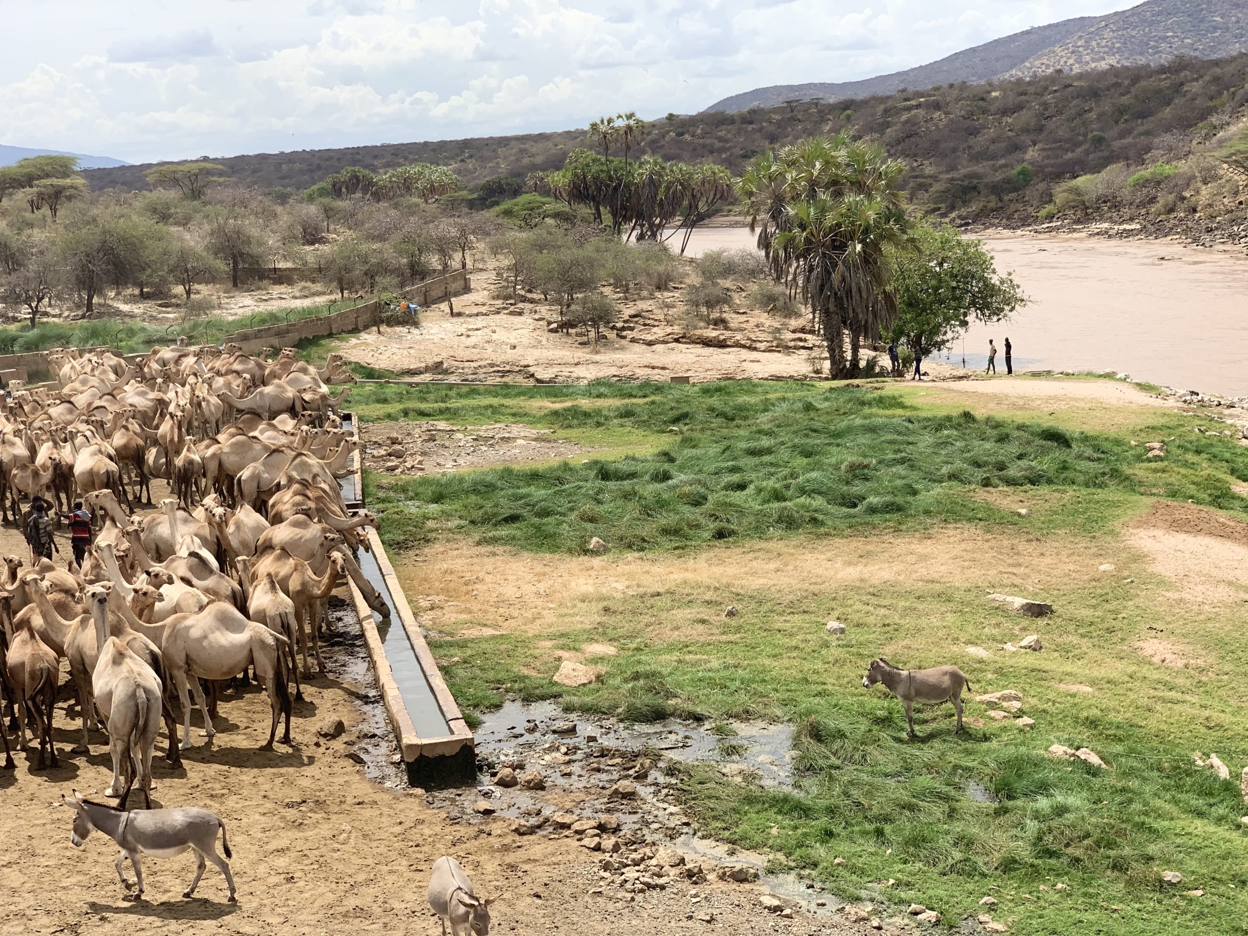
Overhead view of Ewaso Ngiro River in Gotu Location, Isiolo County
In Gotu, this web of authority has created a power vacuum. The root of the crisis lies in the County boundary lines drawn without a historical basis, which conflict with community claims rooted in oral traditions and seasonal grazing patterns. Administratively and politically, Gotu is Ngaremara sub-county and Ngaremara Ward. Geographically and communally, it forms part of the Kulamawe Dedha rangelands. Development projects are initiated by neighboring counties within disputed zones, often bypassing the Isiolo community altogether. The Kulamawe Dedha community views these actions as incursions into their territory. As a result, mistrust increases, and peace becomes strained. Administrators are not in a hurry to reconcile these long-standing tensions. As they give it time, it is getting more complicated.
To address this, we need to return agency to the people. Community land adjudication should be prioritized, not delayed. Civic actors in Isiolo have called for participatory mapping that utilizes oral histories and colonial-era maps. The slow progress of electing Community Land Management Committees in Kina, Kulamawe, & Gotu Dedha is not just a procedural delay—it represents a political risk.
The communities in Isiolo County must defend their territory not only with maps but also through transparency and adherence to the law. Let the National Land Commission, IEBC, and county governments meet with the communities to resolve conflicting boundaries. The Constitution requires public participation. It’s time for institutions to honorthat.
The boundary confusion in Gotu is not just about lines on paper—it’s about protecting heritage, dignity, and constitutional justice. It is worrying that administrators and politicians are finding space in the community process. At the same time, the area of their mandate has remained unattended, thereby complicating the issue and confusing the situation.